Instrument Flight Rules: Difference between revisions
No edit summary |
|||
| (125 intermediate revisions by the same user not shown) | |||
| Line 1: | Line 1: | ||
These notes apply to Australia Instrument Rules. | |||
For USA FAA information see: | |||
* https://www.faa.gov/sites/faa.gov/files/regulations_policies/handbooks_manuals/aviation/instrument_procedures_handbook/FAA-H-8083-16B.pdf | |||
* https://www.faa.gov/sites/faa.gov/files/regulations_policies/handbooks_manuals/aviation/instrument_procedures_handbook/FAA-H-8083-16B.pdf | |||
=disclaimer= | |||
<font color="red">NOTE: I am still drafting these pages</font> | |||
This publication is for my own edification; you need to cross-check and verify the contents and I assume no liability for omissions, mistakes nor for any changes made by CASA - which are continual. | |||
=Introduction= | |||
It is problematic keeping up with CASA regulations because they keep re-writing them, they even have a web-link about how they are changing the rules<ref>CASA changing the rules https://www.casa.gov.au/rules/changing-rules</ref> and seem proud that they are doing so, and paint it in the light that it as good for the industry and safety. Meanwhile they also state that they are the enforcers<ref>CASA compliance and enforcement https://www.casa.gov.au/rules/compliance-and-enforcement</ref>. It seems they are there perpetuating employment for the legislation drafters and inflicting the impost of change on the aviation industry while claiming compatibility with the FARs. Terming this as a self-licking ice-cream would be harsh but that is the observation it engenders. They claim it is a consultative process<ref>CASA consultation https://consultation.casa.gov.au/</ref> proudly as well. | |||
Why Australia has to re-write its own legislation that is incompatible and non-transferable to other Aviation States is the reason that Australia is considered the back-water of Aviation. Our maintenance engineering qualifications<ref>Maintenance Reform https://aopa.com.au/general-aviation-maintenance-regulation-reforms/</ref> and engineering certificates are poorly recognized by the FAA for example. | |||
It is the story of Australian Aviation, me make our own rules instead of recognizing and adopting the world's best FAA system, so as a result our Aviation Industry is suffering e.g. the FAA has pilot self-declared medial certification<ref>self-certification medicals https://aopa.com.au/aopa-australia-continues-call-for-self-certification-medicals-for-rpl-ppl-holders/</ref> that CASA has so far said they need more time to understand and thus for over 6 years are refusing to provide - yet RAAUS has had self-declared medical certification<ref>RAAUS (medical) forms https://www.raa.asn.au/documents-and-forms/forms/</ref> since inception, and fly similar, if not the same aircraft in the same skies. | |||
The new Part 91 changes to the CASR are that comprehensive, and full of legalese, that CASA have developed a [https://www.casa.gov.au/sites/default/files/2021-08/plain-english-guide-part-91-new-flight-operations-regulations-interactive-version.pdf Plain English guide], and they are now up to version 2.0 of this guide, and the [[CASR|CASR 1998]] is not up to drafting 97! | |||
This wiki-page is a collection of my notes used to '''refresh''' myself, and hopefully provide others with indications of the requirements for safe flight under Instrument Flight Rules (IFR)<ref>CASA IFR endorsements https://www.casa.gov.au/licences-and-certificates/pilots/ratings-reviews-and-endorsements/ratings-and-endorsements/instrument-ratings-and-endorsements#</ref>, and forms part of my self-training material. There are several sources containing information on the web for the proficient IFR pilot, and I can recommend the [https://weflyplanes.com.au/|IFR Cheat Sheet]<ref>IFR Cheat Sheet - we fly planes https://weflyplanes.com.au/</ref> as a good source. | |||
=Instrument Flight Rules= | |||
The [[IFR_Regulations]] are spread across the [[CASR 1998]], Manual of Standards for each relevant Part, and with advisories in the [[AIP]]. Since the legisation is at the 97 draft of [[CASR 1998]] and moving around we have some items in [[CASR 1998]] and others in the MOS; the [[IFR Regulations]] is a page with pointers/hints as to where to find relevant regulation. It is very difficult to site law when the law keeps changing (call [[IFR_Regulations]] as the cross-reference sheet which can be used and updated when the regulations are change. I will use it to find and correct references in the other pages on a case-by-case basis. | |||
=fuel reserves= | |||
* [[Part 91 MOS]] CASR Part 91 MOS Chapter 19, table 19.02 (2), Item 3 for aeroplanes with MTOW less than 5,700 kg (piston engine or turboprop) under IFR, or | |||
* [[Part 135 MOS]], CASR Part 135 MOS Chapter 7. | |||
* 91.455 Fuel requirements (MOS 19.02) | |||
:At commencement of a flight the minimum amount of usable fuel required to be onboard at the commencement of a flight must be the sum of: | |||
:*taxi fuel | |||
:*trip fuel | |||
:*destination alternate fuel (if required) | |||
:*holding fuel (if required) | |||
:*contingency fuel (if applicable) | |||
:*final reserve fuel | |||
:*additional fuel (if applicable) | |||
=radio calls= | |||
===class-C airspace=== | |||
TBA (I was trained and live under class-C airspace and will provide this later for the edification of others_ | |||
===class-D airspace=== | |||
TBA (I was not trained specifically in class-D airspace and find it a little strange - I will provide this later for my edification | |||
===class-G airspace=== | |||
{| class="wikitable" | |||
! Situation || Report | |||
|+ | |||
| Taxiing || Report the situation | |||
|+ | |||
| Departure || Report the situation | |||
|+ | |||
| Reaching cruising level || Report the situation | |||
|+ | |||
| Position report when required by ATC, or route reporting requirements of the AIP || Report the situation | |||
|+ | |||
| Previously reported position estimate is more than 2 minutes in error (and '''not identified''' by Radar/ADS-B) || Report Situation | |||
|+ | |||
| Before changing level || Report the situation | |||
|+ | |||
| Before changing frequency || Report the situation | |||
|+ | |||
| Requiring clearance into controlled airspace || Report the situation (strange ATC usually tell you) | |||
|+ | |||
| Before leaving controlled airspace on descent || Report the situation (stange usually ATC tell you clear to leave controlled area on descent | |||
|+ | |||
| Before changing to CTAF (when not monitoring the ATS frequency on a second communication system) || Report the situation | |||
|+ | |||
| After landing If cancelling SARWATCH || cancel SARWATCH destination | |||
|} | |||
=equipment= | |||
{| | |||
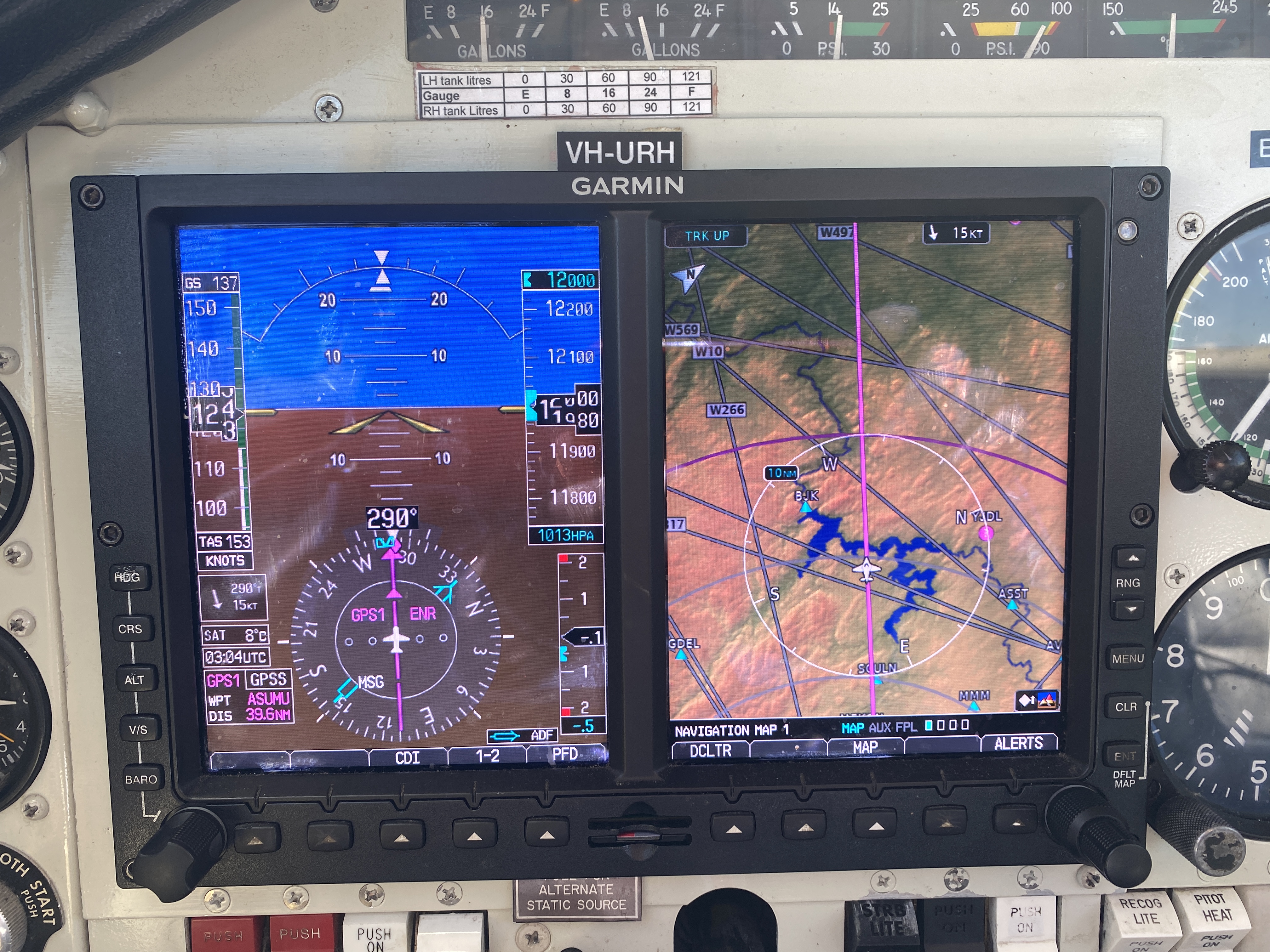
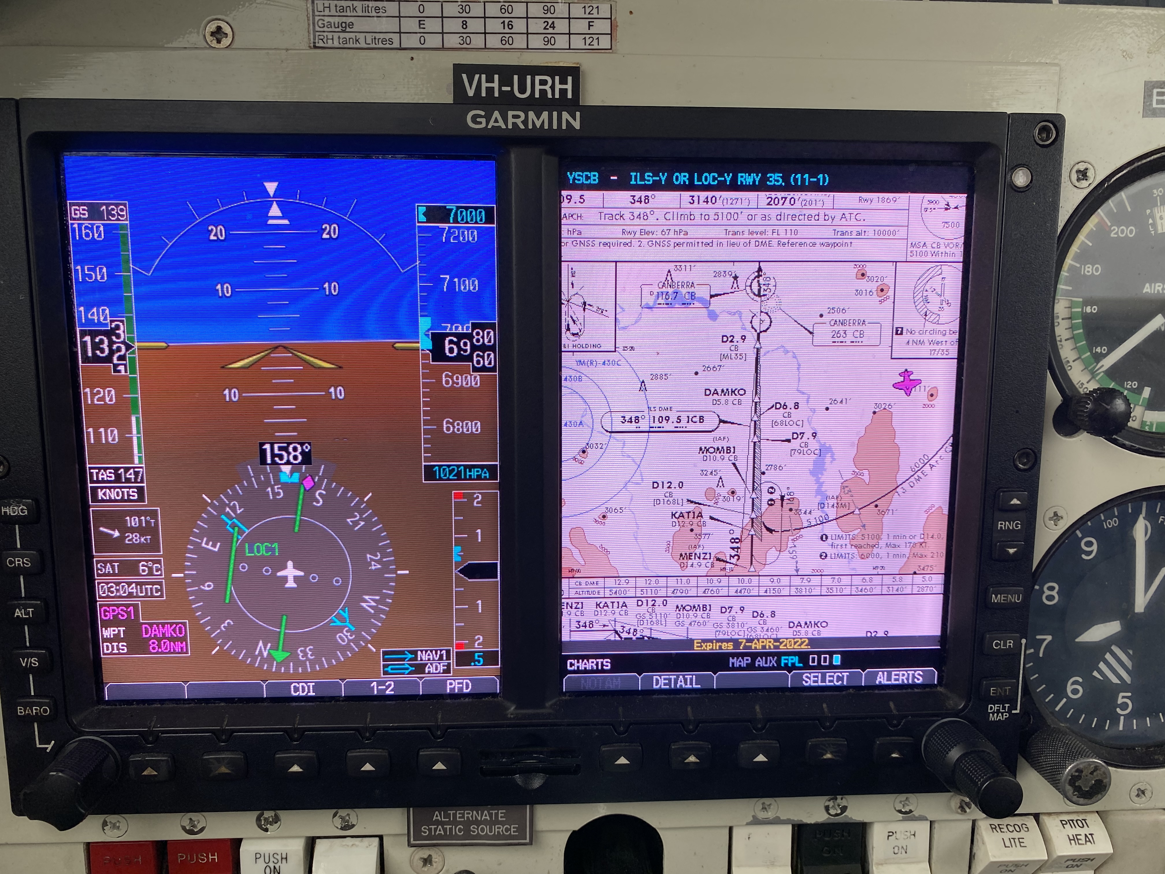
| [[image:PFD-MFD-enroute.jpg|500px|thumb|Garmin G500 PFD with MFD terrain and NAV map|none]] || [[image:PFD-MFD-ILS.jpg|500px|thumb|Garmin G500 ILS approach with vectors class-C]] | |||
|+ | |||
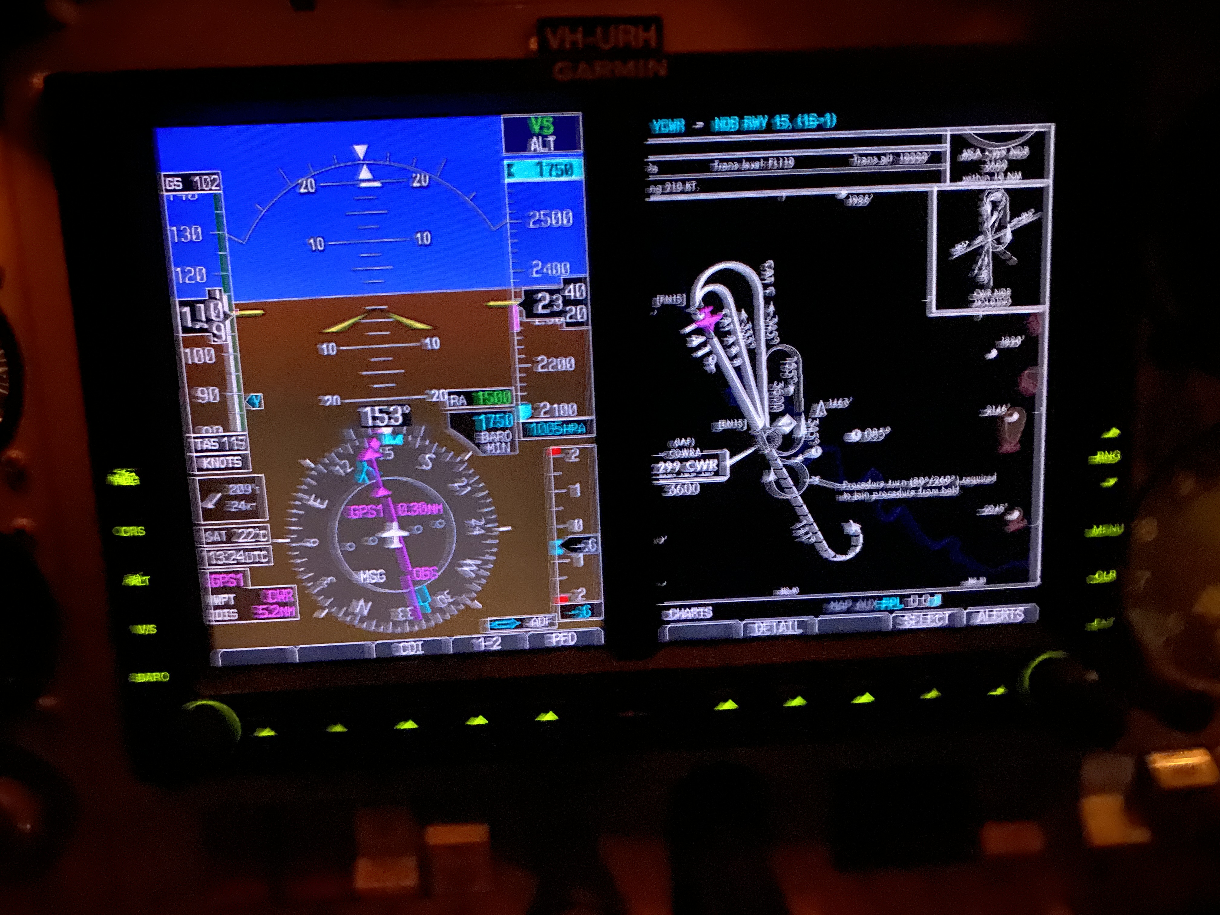
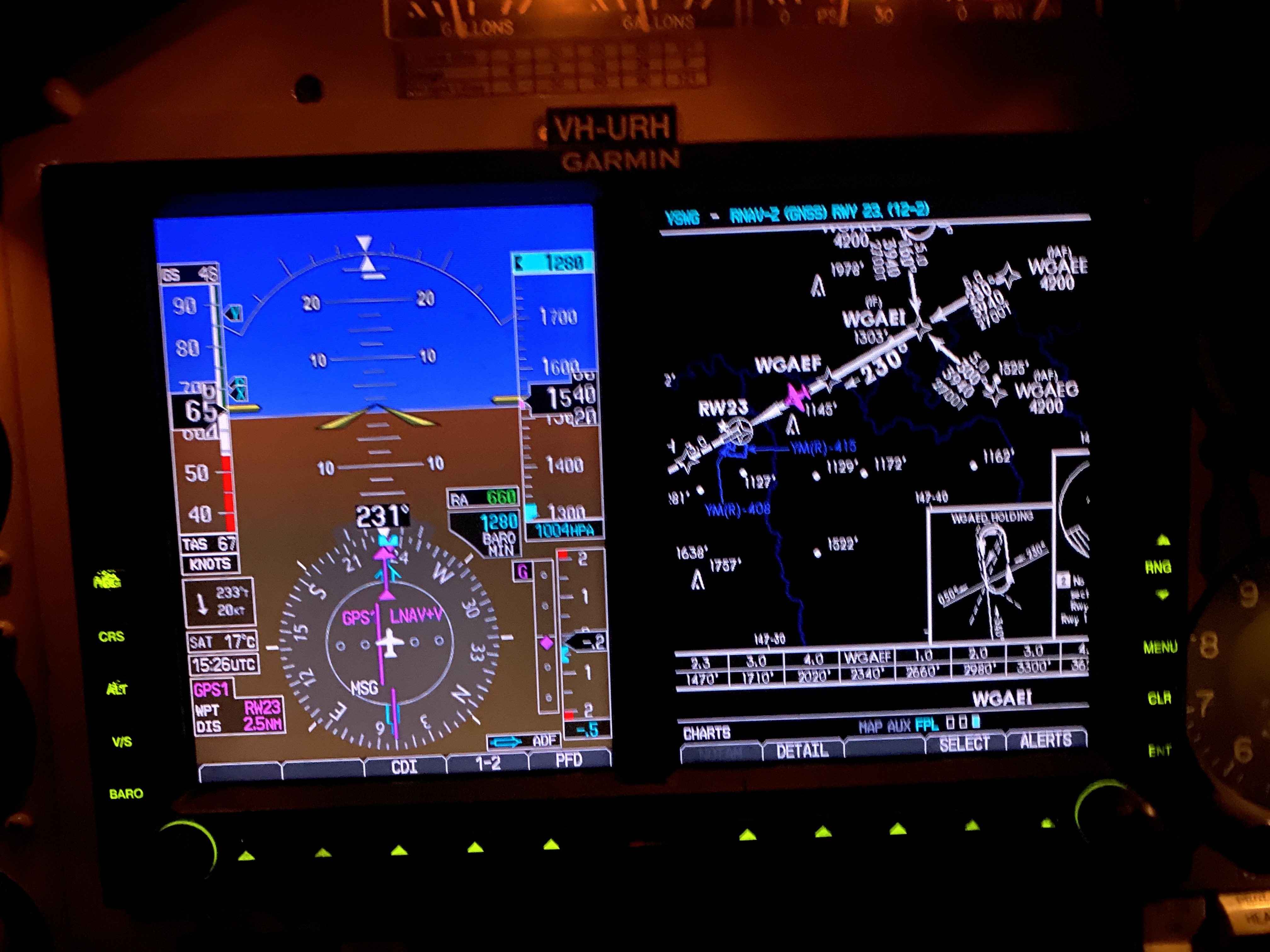
| [[image:PFD-NDB.jpg|500px|thumb|Garmin G500 2D approach with azimuth and lateral guidance]] || [[image:PFB-RNAV.jpg|500px|thumb|Garmin G500 3D RNAV/LVP | |||
approach]] | |||
|} | |||
I will concentrate of modern aircraft equipment where information is displayed on | |||
* Primary Function Display which displays: | |||
** speed | |||
*** Ground Speed - sourced from GPS | |||
*** Indicated Airspeed - sourced from pitot-static system pressure differential | |||
*** True Air Speed - calculated from GS, IAS, OAT and pressure altitude | |||
** vertical speed (tape) | |||
** altitude tape - with altitude bug | |||
** Artificial Horizon | |||
** HSI - with heading bug and Course Deviation Indicator | |||
** Vertical Guidance window - with GS bug and vertical speed advisories | |||
** Radar Altimeter | |||
** Altitude Mimimums - area, approach and Decision Altitude | |||
* Multi Function Display which can display: | |||
** Maps | |||
** Terrain | |||
** Traffic Information or Traffic Collision Advisories | |||
=resolution= | |||
[[image:G500-HSI.jpg|thumb|500px|snapped from the web; the pilot in me says mate you are not going to intercept that with a rate one turn|none]] | |||
[[image:Analogue_HSI.jpg|thumb|500px|analogue HSI|none]] | |||
{| class="wikitable" | |||
! colspan=2 | CDI / LOC HSI | |||
|+ | |||
| Enroute: || (+-) 5.0nm | |||
|+ | |||
| Enroute WAAS/ENR 2.0 || (+-) 2.0nm WAAS | |||
|+ | |||
| Terminal: || (+-) 1.0nm | |||
|+ | |||
| Approach: || (+-) 0.3nm | |||
|+ | |||
| VOR CDI || full scale is 10 degrees | |||
|+ | |||
| ILS CDI || full scale is 2.5 degrees | |||
|+ | |||
| GS || full scale is 0.7 degrees | |||
|} | |||
For a two dot scale in VOR mode; each dot is 5 degrees; for a 5 dot scale the dots are 2 degrees. A missed approach is initiated when the CDI reaches half-scale. | |||
{| class="wikitable" | |||
! Parameter !! Tolerance | |||
|+ | |||
| azimuth guidance using NDB || +/- 5 degrees of nominated track using azimuth guidance | |||
|+ | |||
| 2D approach lateral guidance|| +/- half scale using CDI (which includes CDI on NDB waypoint)<br/>+/- 2 nm of DME / GNSS arc | |||
|+ | |||
| 3D lateral lateral || +/- half scale using CDI<br/>+/- 2 nm of DME / GNSS arc | |||
|+ | |||
| 3D vertical guidance || +/- half scale<br/> +/- 75' for RNP Baro VNAV<br/>for RNP LVP aircraft configuration above half scale are acceptible<br/>transients above 1/2 in turbulence are acceptable | |||
|+ | |||
| Minimum Altitude || +100'.- 0' limits<br/>Missed Approach must be initiate above Minimms | |||
|} | |||
=Alternates= | |||
[[Part 91 MOS#Alternates|Part 91 MOS 8.04-8.08]] | |||
Alternates Could Very Well Prove Life Savers. | |||
Alternates are required when: | |||
* Aids - alternate is required for destination not served by an approach (the pilot can use), alternate minima is as published in an approach, or is enroute LSALT + 500'. | |||
* Cloud - alternate is required when arrival is up to 30 minutes prior to forecast of | |||
** cloud more that SCT below algternate minima | |||
** visibility less than alternate minima, or forecast is 30& prob of fog, mist, dust or other visibility limitation | |||
** cross-wind more than the capability of the aircraft (or pilot) | |||
* Provided and Probability - when forecast not provided, or TAF has probability of conditions below the alternate minima | |||
* Lighting - alternate required when portable lighting is in use, or there is no standby power, or PAL if a responsible person is not in attendance. | |||
:dual VHF; or VHF, HF and 30 minutes of fuel to allow alert of ground staff; or sufficient fuel until daylight | |||
* Storms - alternate required when arrival is within 30 minutes prior of a forecast of thunderstorms or turbulence of at least 30% probability | |||
: additional fuel must be carried, in the event of INTER 30 minutes, or TEMPO 60 minutes. | |||
Special alternate minima are available for dual equipped ILS/VOR capable aircraft only. | |||
=Departure Requirements= | |||
Pilot must check the accuracy of their altimeter at some point before take off. | |||
For IFR: | |||
* altitude must be within 60' (in excess of +/- 75' the altimeter is unserviceable) | |||
* two altimeters then one must be within the 60' and the other placarded unserviceable | |||
QNH is considered accurate if provided by ATIS, Tower or AWIS. (Area QNH must not be used for the altimeter test.) | |||
Altimeter QNH can also be confirmed via site Elevation. | |||
=takeoff minima= | |||
A pilot in command must not commence a takeoff if | |||
* meterological conditions are less than the minimum takeoff of the aircraft, | |||
* or worse than landing minima for any IAP the pilot can conduct to allow a visual approach to land. | |||
For eligable multi-engine aircraft : | |||
* 800 m visibikity (or 550m under some conditions) | |||
For single engine take-off minimas are: | |||
* cloud ceiling above 300' | |||
* visibility of 2000m or above | |||
=holds= | |||
* Sector 1 (Parallel entry) - over aid fly parallel to inbound track and turn to intercept inbound track to the aid after an appropriate time making allowance for wind (10 seconds delay into turning parallel, then one minute turning inbound), when back over the aid turn to follow the hold | |||
* Sector 2 (Tear drop) - over the aid turn 30 degrees from the reciprocal of the inbound track up to 1 min 30 secs, or until DME limit reached, then flown inbound to intercept inbound track, then turned at the aid to follow the hold. | |||
* Sector 3 (Direct Entry) On reaching the holding fix turn to follow the hold | |||
Timing: | |||
* The outbound turn is timed from abeam the fix, | |||
* or when wings are level if abeam cannot be determined, | |||
* and which ever comes later. | |||
Hold timings must be no longer than | |||
* than one minute below FL140 | |||
* 1.5 minutes above FL140, or DME limit | |||
All turns in nil wind shall be < 25 degrees or rate one, which ever is the lessor | |||
Wind allowance should be made in heading and timing to compensate for wind effects to ensure inbound track is regained before passing the fix | |||
=Approaches= | |||
Prior to an approach the PIC must set QNH to: | |||
* actual aerodrome QNH | |||
* or forecast TAF QNH if aerodrome QNH | |||
* Aread QNH if no other source available | |||
Landing minima may be reduced by 100' when using actual aerodrome QNH (on shaded charts or Jeppesen charts when provided); when a TAF forecast is used the minima must be increased by 50'. | |||
The QNH from an approved source is only valid for 15 minutes. | |||
An approach may only occur below the straight-in MDA or below an Approach DA when | |||
* visual reference can be maintained | |||
* all elements of meterological minima are equal or greater than those for the aircraft | |||
* and the aircraft is continuously in a position where descent to the runway can be done in a normal rate that will allow touchdown. | |||
Procedures: | |||
* Standard Instrument Departure | |||
* Standard Arrivals | |||
* DME Arrival | |||
* Approaches | |||
There are quite a few different types of approaches | |||
* lateral guidance only +/-5 degrees non-precision [[How to fly an NDB approach|NDB#Approach]] | |||
** lateral guidance with CDI from GPS set to verified NDB way-point +/5 degrees (1/2 scale is +/- 5 degrees) - don't fly with this if you want to retain NDB trade-craft | |||
* GNSS RNAV/LVP - advisory vertical guidance with simulated GS and Baro Nav corrected step-down/DME chart - abort > 1/2 scale lateral or vertical or with unexplained discrepancy | |||
* GNSS RVAP - Baro Nav correct step-down/DME chart guidance (for 3 degrees set VSI descent rate fpm to 5 x Ground Speed in Kts) - abort > 1/2 scale lateral or unexplained discrepancy | |||
* ILS LOC/GS - Precision Approach with step-down/DME chart for verification (3 degrees set VSI descent rate fpm to 5 x Ground Speed in Kts) - abort on reaching fullscale CDI deflection - preferably retaining the CDI deflection < 1/2 scale (ENR 1.16) | |||
* VOR - Non precision approach CDI abort 1/2 scale +/- 5 degrees, vertical guidance if via Baro corrected step-down DME chart | |||
=references= | =references= | ||
<references> | <references/> | ||
[[category:IFR]] | [[category:IFR]] | ||
[[Category:Ralph_Holland:Publications]] | [[Category:Ralph_Holland:Publications]] | ||
[[category:aviation Publication]] | |||
[[category:Aviation]] | |||
[[category:Ralph Holland:Publications]] | |||
[[category:Instrument Flying]] | |||
[[category:public]] | |||
[[category:CASA]] | |||
Latest revision as of 15:20, 14 February 2025
These notes apply to Australia Instrument Rules. For USA FAA information see:
- https://www.faa.gov/sites/faa.gov/files/regulations_policies/handbooks_manuals/aviation/instrument_procedures_handbook/FAA-H-8083-16B.pdf
- https://www.faa.gov/sites/faa.gov/files/regulations_policies/handbooks_manuals/aviation/instrument_procedures_handbook/FAA-H-8083-16B.pdf
disclaimer
NOTE: I am still drafting these pages
This publication is for my own edification; you need to cross-check and verify the contents and I assume no liability for omissions, mistakes nor for any changes made by CASA - which are continual.
Introduction
It is problematic keeping up with CASA regulations because they keep re-writing them, they even have a web-link about how they are changing the rules[1] and seem proud that they are doing so, and paint it in the light that it as good for the industry and safety. Meanwhile they also state that they are the enforcers[2]. It seems they are there perpetuating employment for the legislation drafters and inflicting the impost of change on the aviation industry while claiming compatibility with the FARs. Terming this as a self-licking ice-cream would be harsh but that is the observation it engenders. They claim it is a consultative process[3] proudly as well.
Why Australia has to re-write its own legislation that is incompatible and non-transferable to other Aviation States is the reason that Australia is considered the back-water of Aviation. Our maintenance engineering qualifications[4] and engineering certificates are poorly recognized by the FAA for example.
It is the story of Australian Aviation, me make our own rules instead of recognizing and adopting the world's best FAA system, so as a result our Aviation Industry is suffering e.g. the FAA has pilot self-declared medial certification[5] that CASA has so far said they need more time to understand and thus for over 6 years are refusing to provide - yet RAAUS has had self-declared medical certification[6] since inception, and fly similar, if not the same aircraft in the same skies.
The new Part 91 changes to the CASR are that comprehensive, and full of legalese, that CASA have developed a Plain English guide, and they are now up to version 2.0 of this guide, and the CASR 1998 is not up to drafting 97!
This wiki-page is a collection of my notes used to refresh myself, and hopefully provide others with indications of the requirements for safe flight under Instrument Flight Rules (IFR)[7], and forms part of my self-training material. There are several sources containing information on the web for the proficient IFR pilot, and I can recommend the Cheat Sheet[8] as a good source.
Instrument Flight Rules
The IFR_Regulations are spread across the CASR 1998, Manual of Standards for each relevant Part, and with advisories in the AIP. Since the legisation is at the 97 draft of CASR 1998 and moving around we have some items in CASR 1998 and others in the MOS; the IFR Regulations is a page with pointers/hints as to where to find relevant regulation. It is very difficult to site law when the law keeps changing (call IFR_Regulations as the cross-reference sheet which can be used and updated when the regulations are change. I will use it to find and correct references in the other pages on a case-by-case basis.
fuel reserves
- Part 91 MOS CASR Part 91 MOS Chapter 19, table 19.02 (2), Item 3 for aeroplanes with MTOW less than 5,700 kg (piston engine or turboprop) under IFR, or
- Part 135 MOS, CASR Part 135 MOS Chapter 7.
- 91.455 Fuel requirements (MOS 19.02)
- At commencement of a flight the minimum amount of usable fuel required to be onboard at the commencement of a flight must be the sum of:
- taxi fuel
- trip fuel
- destination alternate fuel (if required)
- holding fuel (if required)
- contingency fuel (if applicable)
- final reserve fuel
- additional fuel (if applicable)
radio calls
class-C airspace
TBA (I was trained and live under class-C airspace and will provide this later for the edification of others_
class-D airspace
TBA (I was not trained specifically in class-D airspace and find it a little strange - I will provide this later for my edification
class-G airspace
| Situation | Report |
|---|---|
| Taxiing | Report the situation |
| Departure | Report the situation |
| Reaching cruising level | Report the situation |
| Position report when required by ATC, or route reporting requirements of the AIP | Report the situation |
| Previously reported position estimate is more than 2 minutes in error (and not identified by Radar/ADS-B) | Report Situation |
| Before changing level | Report the situation |
| Before changing frequency | Report the situation |
| Requiring clearance into controlled airspace | Report the situation (strange ATC usually tell you) |
| Before leaving controlled airspace on descent | Report the situation (stange usually ATC tell you clear to leave controlled area on descent |
| Before changing to CTAF (when not monitoring the ATS frequency on a second communication system) | Report the situation |
| After landing If cancelling SARWATCH | cancel SARWATCH destination |
equipment
 |
 |
 |
 |
I will concentrate of modern aircraft equipment where information is displayed on
- Primary Function Display which displays:
- speed
- Ground Speed - sourced from GPS
- Indicated Airspeed - sourced from pitot-static system pressure differential
- True Air Speed - calculated from GS, IAS, OAT and pressure altitude
- vertical speed (tape)
- altitude tape - with altitude bug
- Artificial Horizon
- HSI - with heading bug and Course Deviation Indicator
- Vertical Guidance window - with GS bug and vertical speed advisories
- Radar Altimeter
- Altitude Mimimums - area, approach and Decision Altitude
- speed
- Multi Function Display which can display:
- Maps
- Terrain
- Traffic Information or Traffic Collision Advisories
resolution
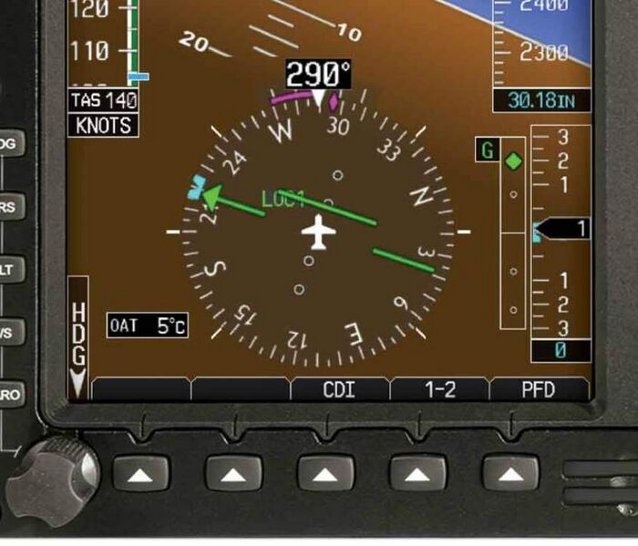
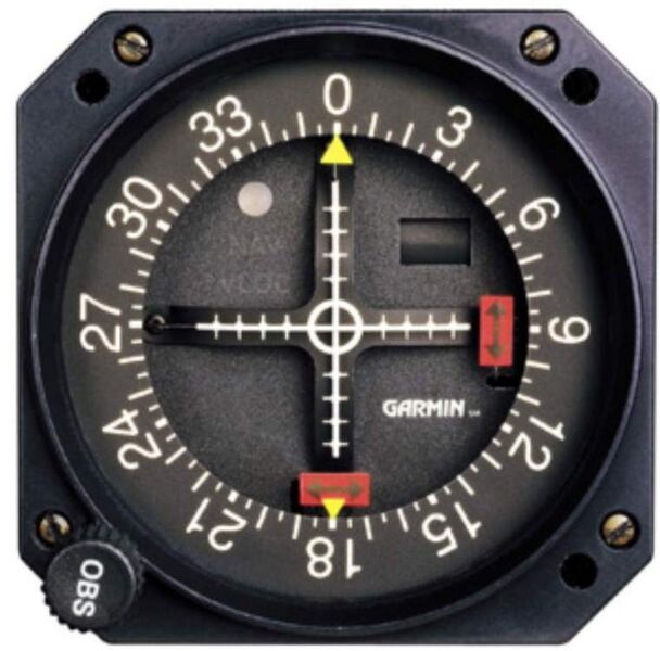
| CDI / LOC HSI | |
|---|---|
| Enroute: | (+-) 5.0nm |
| Enroute WAAS/ENR 2.0 | (+-) 2.0nm WAAS |
| Terminal: | (+-) 1.0nm |
| Approach: | (+-) 0.3nm |
| VOR CDI | full scale is 10 degrees |
| ILS CDI | full scale is 2.5 degrees |
| GS | full scale is 0.7 degrees |
For a two dot scale in VOR mode; each dot is 5 degrees; for a 5 dot scale the dots are 2 degrees. A missed approach is initiated when the CDI reaches half-scale.
| Parameter | Tolerance |
|---|---|
| azimuth guidance using NDB | +/- 5 degrees of nominated track using azimuth guidance |
| 2D approach lateral guidance | +/- half scale using CDI (which includes CDI on NDB waypoint) +/- 2 nm of DME / GNSS arc |
| 3D lateral lateral | +/- half scale using CDI +/- 2 nm of DME / GNSS arc |
| 3D vertical guidance | +/- half scale +/- 75' for RNP Baro VNAV for RNP LVP aircraft configuration above half scale are acceptible transients above 1/2 in turbulence are acceptable |
| Minimum Altitude | +100'.- 0' limits Missed Approach must be initiate above Minimms |
Alternates
Alternates Could Very Well Prove Life Savers.
Alternates are required when:
- Aids - alternate is required for destination not served by an approach (the pilot can use), alternate minima is as published in an approach, or is enroute LSALT + 500'.
- Cloud - alternate is required when arrival is up to 30 minutes prior to forecast of
- cloud more that SCT below algternate minima
- visibility less than alternate minima, or forecast is 30& prob of fog, mist, dust or other visibility limitation
- cross-wind more than the capability of the aircraft (or pilot)
- Provided and Probability - when forecast not provided, or TAF has probability of conditions below the alternate minima
- Lighting - alternate required when portable lighting is in use, or there is no standby power, or PAL if a responsible person is not in attendance.
- dual VHF; or VHF, HF and 30 minutes of fuel to allow alert of ground staff; or sufficient fuel until daylight
- Storms - alternate required when arrival is within 30 minutes prior of a forecast of thunderstorms or turbulence of at least 30% probability
- additional fuel must be carried, in the event of INTER 30 minutes, or TEMPO 60 minutes.
Special alternate minima are available for dual equipped ILS/VOR capable aircraft only.
Departure Requirements
Pilot must check the accuracy of their altimeter at some point before take off.
For IFR:
- altitude must be within 60' (in excess of +/- 75' the altimeter is unserviceable)
- two altimeters then one must be within the 60' and the other placarded unserviceable
QNH is considered accurate if provided by ATIS, Tower or AWIS. (Area QNH must not be used for the altimeter test.) Altimeter QNH can also be confirmed via site Elevation.
takeoff minima
A pilot in command must not commence a takeoff if
- meterological conditions are less than the minimum takeoff of the aircraft,
- or worse than landing minima for any IAP the pilot can conduct to allow a visual approach to land.
For eligable multi-engine aircraft :
- 800 m visibikity (or 550m under some conditions)
For single engine take-off minimas are:
- cloud ceiling above 300'
- visibility of 2000m or above
holds
- Sector 1 (Parallel entry) - over aid fly parallel to inbound track and turn to intercept inbound track to the aid after an appropriate time making allowance for wind (10 seconds delay into turning parallel, then one minute turning inbound), when back over the aid turn to follow the hold
- Sector 2 (Tear drop) - over the aid turn 30 degrees from the reciprocal of the inbound track up to 1 min 30 secs, or until DME limit reached, then flown inbound to intercept inbound track, then turned at the aid to follow the hold.
- Sector 3 (Direct Entry) On reaching the holding fix turn to follow the hold
Timing:
- The outbound turn is timed from abeam the fix,
- or when wings are level if abeam cannot be determined,
- and which ever comes later.
Hold timings must be no longer than
- than one minute below FL140
- 1.5 minutes above FL140, or DME limit
All turns in nil wind shall be < 25 degrees or rate one, which ever is the lessor
Wind allowance should be made in heading and timing to compensate for wind effects to ensure inbound track is regained before passing the fix
Approaches
Prior to an approach the PIC must set QNH to:
- actual aerodrome QNH
- or forecast TAF QNH if aerodrome QNH
- Aread QNH if no other source available
Landing minima may be reduced by 100' when using actual aerodrome QNH (on shaded charts or Jeppesen charts when provided); when a TAF forecast is used the minima must be increased by 50'.
The QNH from an approved source is only valid for 15 minutes.
An approach may only occur below the straight-in MDA or below an Approach DA when
- visual reference can be maintained
- all elements of meterological minima are equal or greater than those for the aircraft
- and the aircraft is continuously in a position where descent to the runway can be done in a normal rate that will allow touchdown.
Procedures:
- Standard Instrument Departure
- Standard Arrivals
- DME Arrival
- Approaches
There are quite a few different types of approaches
- lateral guidance only +/-5 degrees non-precision NDB#Approach
- lateral guidance with CDI from GPS set to verified NDB way-point +/5 degrees (1/2 scale is +/- 5 degrees) - don't fly with this if you want to retain NDB trade-craft
- GNSS RNAV/LVP - advisory vertical guidance with simulated GS and Baro Nav corrected step-down/DME chart - abort > 1/2 scale lateral or vertical or with unexplained discrepancy
- GNSS RVAP - Baro Nav correct step-down/DME chart guidance (for 3 degrees set VSI descent rate fpm to 5 x Ground Speed in Kts) - abort > 1/2 scale lateral or unexplained discrepancy
- ILS LOC/GS - Precision Approach with step-down/DME chart for verification (3 degrees set VSI descent rate fpm to 5 x Ground Speed in Kts) - abort on reaching fullscale CDI deflection - preferably retaining the CDI deflection < 1/2 scale (ENR 1.16)
- VOR - Non precision approach CDI abort 1/2 scale +/- 5 degrees, vertical guidance if via Baro corrected step-down DME chart
references
- ↑ CASA changing the rules https://www.casa.gov.au/rules/changing-rules
- ↑ CASA compliance and enforcement https://www.casa.gov.au/rules/compliance-and-enforcement
- ↑ CASA consultation https://consultation.casa.gov.au/
- ↑ Maintenance Reform https://aopa.com.au/general-aviation-maintenance-regulation-reforms/
- ↑ self-certification medicals https://aopa.com.au/aopa-australia-continues-call-for-self-certification-medicals-for-rpl-ppl-holders/
- ↑ RAAUS (medical) forms https://www.raa.asn.au/documents-and-forms/forms/
- ↑ CASA IFR endorsements https://www.casa.gov.au/licences-and-certificates/pilots/ratings-reviews-and-endorsements/ratings-and-endorsements/instrument-ratings-and-endorsements#
- ↑ IFR Cheat Sheet - we fly planes https://weflyplanes.com.au/
